Antarctic ice thicker than thought, drone submarine finds

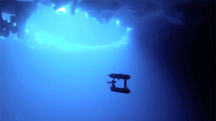
A new type of 3D mapping revealed Antarctic sea ice could be much thicker than previously estimated, shows a study done with the help of a yellow robotic submarine named SeaBed.
The new study, published in Nature Geoscience, showed that average ice thickness in Antarctica is between 1.4 meters and 5.5 meters. The maximum thickness recorded was 17 meters.
Also, 76 percent of the mapped ice has been tagged as ‘deformed,’ the study stated, which means that ice crashed together, forming a thicker layers of ice.
“Our surveys indicate that the floes are much thicker and more deformed than reported by most drilling and ship-based measurements of Antarctic sea ice,” states the study. “We suggest that thick ice in the near-coastal and interior pack may be under-represented in existing in situ assessments of Antarctic sea ice and hence, on average, Antarctic sea ice may be thicker than previously thought.”
SeaBed robot has been involved in two expeditions in Antarctica with scientists from the UK, the US and Australia. The yellow robot is an autonomous underwater vehicle (or AUV) equipped with upward-looking sonar to measure and map the underwater sea ice.
The two-meter robot moved in a “lawnmower” pattern so as not to miss any areas and bounced sound waves off the under-surface of the ice to make its estimates.
Two expeditions took place in 2010 and 2012 and included regions of Weddell, Bellingshausen, and Wilkes Land.
Overall, an area of 500,000 meters squared was analyzed by members of the British Antarctic Survey, the Institute of Marine and Antarctic Studies (IMAS) in Tasmania and the Woods Hole Oceanographic Institution in the US.
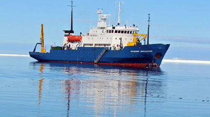
Before the discovery, ice thickness in Antartica could only be measured through the ice breaking ships, which usually stay around the thinner ice regions.
The revelations represent a breakthrough in the field, The Guardian quoted co-author of the study and a member of IMAS, Dr. Guy Williams, as saying.
“Sea ice is an important indicator of the polar climate but measuring its thickness has been tricky,” said Williams. “Along with the satellite data, it was a bit like taking an X-ray of the ice, although we haven’t X-rayed much of it, just a postage stamp.”
“The key thing is that this is a game changer because it was previously very challenging to measure ice depth. We were limited to visual observation from the decks of ships or ice cores and take measures.”


