Magnitude 5.9 quake hits central Australia at 10km depth – USGS
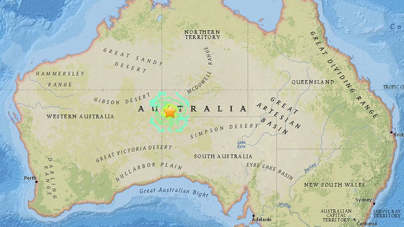
A magnitude 5.9 earthquake has hit Australia some 460 kilometers southwest of the town of Alice Springs in the country’s Northern Territory, the US Geological Survey has reported.
According to USGS, the epicenter of the quake occurred at a shallow depth of 10 kilometers.
There have so far been no reports of casualties or destruction so far.
The earthquake took place on Saturday at 3:54 am local time in a sparsely populated area southeast of Kaltukatjara in the Northern Territory and northwest of Kalka Homeland in South Australia, BNO News reported.
The earthquake may have been felt as far as 507 kilometers from its epicenter, although any damage would be limited to a 40 kilometer radius, according to Geoscience Australia estimations.
The current quake is one of the strongest to hit mainland Australia since August 1997, when a 6.3-magnitude earthquake was recorded off Collier Bay on the far north coast of West Australia.
