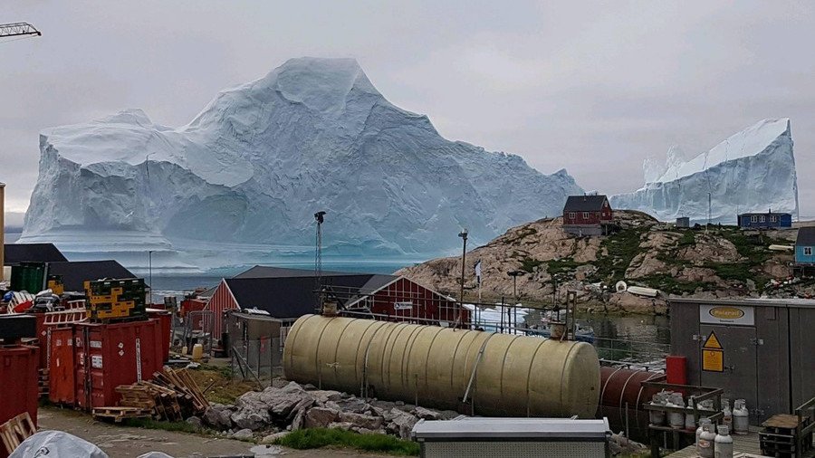
Iceberg from space: Epic satellite pics show 11mn-ton ‘tsunami threat’ beside Greenland village

Stunning new satellite images have laid bare the sheer size of the threat posed to a Greenland fishing community by an 11-million-ton iceberg which has floated into the nearby bay.
READ MORE: Iceberg tsunami warning: Greenland fishing village on red alert as locals gripped by fear
Pictures captured by satellite imaging firm Deimos show the mountain-sized iceberg looming over Innaarsuit, a small island in western Greenland with a population of 170. Locals say the iceberg, which reportedly rises to around 100 meters above the water, is the biggest they have ever seen – and there is a real risk that the iceberg could break apart and create tsunami-like waves that would devastate nearby towns.
#DEIMOS2 captured massive 11-million-ton #iceberg looming over #Greenland's remote village Innaarsuit on Jul. 20 pic.twitter.com/qJwRUOdGmZ
— Deimos Imaging (@deimosimaging) July 24, 2018
READ MORE: Enormous 4 mile long iceberg filmed breaking from Greenland glacier (VIDEO)
“This one makes me afraid,” fisherman Hans Mathias Kristensen told CNN. “My father taught me when an iceberg is stuck on the ground, the ice beneath the waters gets smaller, melts and eventually breaks. There would be huge waves if that breaks up.”
READ MORE: Huge fleet of 400+ icebergs invades North Atlantic shipping lanes
A danger zone close to the coastline has been evacuated. Four people died last summer after waves from a broken iceberg swamped a settlement in the northwest of the island nation.
Think your friends would be interested? Share this story!


