Be Pluto’s Valentine! NASA colors dwarf planet’s ‘heart’ (to study terrain)

Astronomers have gotten straight to the heart of Pluto, striving to explain the dwarf planet’s geological complexity and evolution. Pluto’s iconic “broken heart” region is again in the scientific spotlight on a newly-released NASA colored map.
In July, we learned from NASA’s “most detailed” image of Pluto ever that the dwarf planet has a “heart”. The mysterious surface of the Tombaugh Region – the “heart’s” scientific name – has been of keen interest to New Horizons’ researchers.
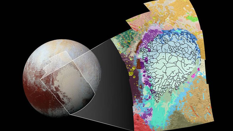
In order to figure out Pluto’s “badlands” and learn more about its evolution, NASA has mapped the “broken heart” and its terrain by painting the map in a variety of color tones. It is probably a mere coincidence the release comes mere days ahead of the Valentine’s Day craze.
High-res NASA image shows 150km-wide potential 'cryovolcano' on Pluto https://t.co/jwGr7qvNcMpic.twitter.com/3cc9KlbH4L
— RT America (@RT_America) January 16, 2016
“This map covers a portion of Pluto’s surface that measures 1,290 miles (2,070 kilometers) from top to bottom,” NASA said in a press release.
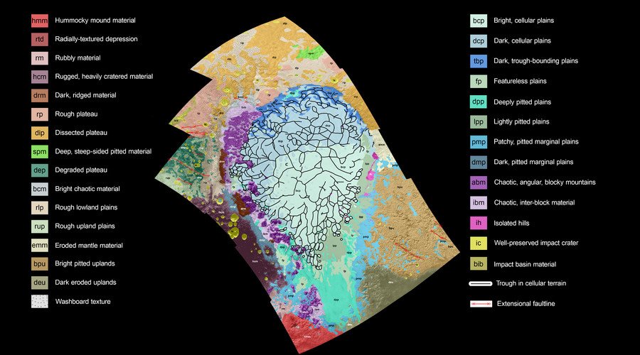
Each of the bright colors in the mosaic-like image stands for a certain type of terrain or “units” varying in texture and morphology: smooth, pitted, craggy, hummocky, or ridged.

For example, bluish blotches are for plains, while purple indicates mountains, and pink is for scattered hills.
“Producing such maps is important for gauging what processes have operated where on Pluto, and when they occurred relative to other processes at work,” NASA says. “By studying how the boundaries between units crosscut one another, mission scientists can determine which units overlie others, and assemble a relative chronology for the different units.”
#Pluto space slugs? High-res @NASA mosaic shows ‘lava lamp’ surface of dwarf planet https://t.co/LjxyzR8THBpic.twitter.com/SY2OnU035y
— RT (@RT_com) January 11, 2016
The “mosaic” was created based on 12 images snapped by the Long Range Reconnaissance Imager (LORRI) about an hour and 40 minutes before New Horizons’ closest approach to Pluto on July 14, when it was 48,000 miles away.


