Haunting images show scale of Oregon wildfire visible from space (PHOTOS, VIDEOS)

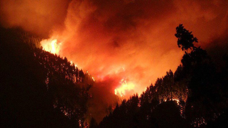
Wildfires are engulfing the Columbia River Gorge in Oregon, with more than 10,000 acres of forest destroyed. The inferno is sending smoke and ash into the sky which is visible from space. Hundreds of people have been forced to evacuate the area.
“The biggest danger isn’t necessarily the fire pushing through — it’s the ash fall,” said Lt. Damon Simmons, spokesman for the Oregon State Fire Marshal’s Office, as cited by The Hood River News.
Ash from the fire has reached as far as the Hood River 47 miles (76km) away with massive smoke trails from the inferno visible from space.
Smoke from Northern fires apparent in satellite imagery. Unfortunately some of this smoke will make it into Northern Utah tomorrow #utwxpic.twitter.com/3EAi7NLPLb
— NWS Salt Lake City (@NWSSaltLakeCity) September 4, 2017
Current G16 GeoColor image showing the thick smoke across much of the Pacific NW. Data prelim, non-operational. #idwx#orwxpic.twitter.com/3v69k9Jzcm
— NWS Boise (@NWSBoise) September 5, 2017
The Eagle Creek fire was man-made, has evaded containment and now covers an area of more than 10,000 acres since it broke out Saturday. The fire even jumped the Columbia River to Washington in the early hours of Tuesday morning, reports King 5 News.
Police interviewed a 15-year-old male from Vancouver, Washington they believe started the fire by setting off fireworks on the Eagle Creek Trail.
Travis Madison was in the area at the weekend and managed to capture some incredible photographs.
“I was up there during the day the fire broke out taking pictures and hiking when all of a sudden I noticed smoke coming from one of the hills. That's when I immediately started taking pics of the fire,” Madison told RT.com.
“I spent the night driving around catching pics of the fire and got as close as I could get. Then, officers were doing mandatory evacuations for residents and hikers because the winds pushed it out of control.”
A total of four fire crews, 29 engines and five helicopters were brought in to tackle the massive fire with additional firefighting planes also called upon. However, the thick clouds of smoke have hampered firefighting efforts, reducing visibility dramatically and grounding air operations.
Unbelievable images as Moffett Creek burns from #EagleCreekFirepic.twitter.com/4yUogkq95h
— Multnomah Co Sheriff (@MultCoSO) September 5, 2017
Water drops on Eagle Creek Fire in the Columbia River Gorge. Fire currently 3,000+ acres. Inciweb: https://t.co/Mev95S5aVcpic.twitter.com/R41cIWLxim
— Forest Service NW (@ForestServiceNW) September 4, 2017
The blaze is located eight miles from the month-old Indian Creek fire which broke out on July 4. More than 500 personnel are involved in containment, rescue and firefighting operations between the Indian and Eagle Creek fires.
Hundreds of local residents were forced to evacuate since Sunday with the most recent evacuation order issued early Tuesday afternoon.
The Oregon Department of Transportation was forced to close Interstate 84 at 6pm Monday, just as Labor Day weekend traffic was returning.
No new updates in the past few hours. Fire PIOs are indicating that the fire has slowed way down for now.
— Multnomah Co Sheriff (@MultCoSO) September 6, 2017
The pace of the fire has slowed dramatically according to police, but major firefighting operations will continue to bring the firestorm under control.


