NASA captures incredible new photo of Mars surface

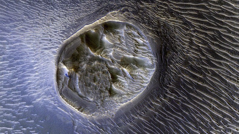
NASA has released incredibly detailed images of a “heavily eroded” Mars, including a fascinating mesa landform surrounded by wild-looking sand dunes and a sea of puzzling secondary craters.
The agency's Mars Reconnaissance Orbiter (MRO) captured the intriguing mesa, which measures 0.4 kilometers, in the “extensively fractured” Noctis Labyrinthus region on the western end of huge Valles Marineris valley.
READ MORE: Aliens, AI & colonies on Mars: Apple’s Wozniak predicts Earth 2075
“Heavily eroded, with clusters of boulders and sand dunes on its surface, this layered mesa is probably comprised of sedimentary deposits that are being exhumed as it erodes. The layers themselves are visible as faint bands along the lower left edge of the mesa,” NASA said.

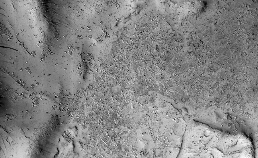
The Reconnaissance Orbiter also recently delivered a bizarre high-resolution image of a region covered in secondary craters from the 10-km Zunil Crater nearby.
While a spray of rocks from a high-impact crater is nothing new on Mars, the agency found the giant bird-like tracks had “an unusual raised-relief appearance like bas-relief sculpture.”
READ MORE: UAE launches space program to boost colonization of Mars by 2021
The agency admits they don’t have a conclusive answer for the mystifying pattern, but suggest the region was covered in a dust-like material about 1-2 meters thick when the Zunil impact occurred about 1 million years ago, “and the ejecta served to harden or otherwise protect the fine-grained layer from later erosion by the wind.”
NASA’s HiRise camera, launched onboard the MRO in 2005, has been delivering high-definition images of the Red Planet that give a greater insight into its fascinating history.


