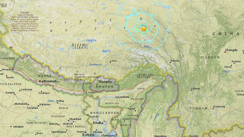
6.4 magnitude earthquake strikes Tibet – USGS

A 6.4 magnitude earthquake has shaken the Himalayan region of Tibet, China, the US Geological Survey reported, adding that the depth of the quake was about 32km.
The tremor took place 17km from the Chinese town of Aduo and 294 km from the city of Chamdo, the USGS reported.
The quake’s epicenter was about 509km from the city of Lhasa, the capital of the Tibet Autonomous Region.
The Himalaya region is considered to be one of the most seismically hazardous regions on Earth. Its high seismicity results mostly from the continental collision of the Indian and Eurasian plates.
1/2 India Kashmir Bhaderwah NDTV (Media) M 3.7, 32.94 75.65 (approx), 14 Oct 04:58:00 UTC 10:28:00 IST https://t.co/o6lZjaABD9pic.twitter.com/otIEqQQxJ7
— tibetearthquake (@aam868) October 16, 2016
The Tibetan Plateau, located north of the Himalaya, stretches about 1,000km north to south, and 2,500km east to west, and is geologically and tectonically complex.


